The agricultural landscape is undergoing a significant transformation, driven by technological advancements aimed at optimizing efficiency, increasing yields, and promoting sustainability. Among these innovations, agricultural drones have emerged as a powerful tool, moving beyond futuristic concepts to become an indispensable part of modern farming practices. Far from being mere flying cameras, these unmanned aerial vehicles (UAVs) integrate sophisticated sensors, advanced imaging capabilities, and powerful data analytics to provide farmers with unprecedented insights into their crops and land.
This article delves into the practical applications of agricultural drones, exploring their core use cases, the underlying workflow that turns raw data into actionable intelligence, and the tangible benefits they offer. We will also address the inherent limitations and risks, providing a balanced perspective for anyone looking to understand the real-world impact of drone technology in agriculture. Our focus is on the concrete ways drones are being utilized today, steering clear of speculative hype to offer a grounded understanding of this rapidly evolving field.
Key Use Cases
Agricultural drones are deployed across a wide spectrum of farming activities, offering precision and efficiency that traditional methods simply cannot match. Their versatility stems from the ability to carry various payloads and execute automated flight paths, gathering data or performing tasks with remarkable accuracy.
Crop Monitoring and Health Assessment
One of the most foundational and impactful uses of agricultural drones is comprehensive crop monitoring. Drones equipped with specialized cameras can capture detailed images that reveal far more than the human eye can perceive.
- Visual Inspection: Standard RGB (red, green, blue) cameras provide high-resolution visual data, allowing farmers to spot issues like uneven growth, pest infestations, or areas of waterlogging. This aerial perspective makes it easy to identify problem spots across vast fields much faster than ground-based scouting.
- Multispectral and Hyperspectral Imaging: This is where drone technology truly shines. Multispectral cameras capture light across specific bands of the electromagnetic spectrum, including near-infrared (NIR). By analyzing how plants reflect these different wavelengths, sophisticated algorithms can calculate various vegetation indices, such as the Normalized Difference Vegetation Index (NDVI). NDVI maps reveal plant vigor, photosynthetic activity, and overall health. Farmers can use these maps to detect early signs of stress caused by nutrient deficiencies, disease, or pest outbreaks, often before symptoms become visible to the naked eye. Hyperspectral cameras offer even finer spectral resolution, providing a more detailed “fingerprint” of plant health. This level of detail allows for highly precise identification of specific diseases or nutrient imbalances. For more on how advanced data helps agriculture, see our article on AI in Agriculture: Revolutionizing the Farm.
Field Mapping and Surveying
Creating accurate and up-to-date maps of agricultural land is crucial for modern farm management. Drones significantly streamline this process, offering high-resolution mapping capabilities.
- Orthomosaic Maps: Drones capture hundreds or thousands of overlapping images of a field. Specialized software then stitches these images together to create a single, georeferenced, high-resolution orthomosaic map. These maps are free of distortions and provide a true-to-scale representation of the field, enabling precise measurements of area, boundaries, and features.
- 3D Terrain Models: By capturing images from multiple angles, drones can generate detailed 3D models of the terrain. This is invaluable for understanding topography, identifying drainage issues, planning irrigation systems, and assessing soil erosion risks.
- Elevation and Contour Maps: Precise elevation data derived from drone surveys helps farmers understand slopes and low spots, which are critical for optimizing water distribution and preventing standing water that can damage crops.
- Variable Rate Application Zones: Based on vegetation health maps and terrain data, drones help delineate specific zones within a field that require different amounts of inputs (fertilizer, water, pesticides). This forms the basis for precision agriculture, ensuring resources are applied only where and when needed. Our piece on Leveraging Geospatial Technology for Business Insights offers broader context on this mapping capability.
Targeted Spraying and Spreading
Historically, applying pesticides, herbicides, or fertilizers involved broadcasting them evenly across an entire field, leading to significant waste and potential environmental impact. Drones enable highly targeted applications.
- Precision Application: Equipped with tanks and spray nozzles, agricultural drones can deliver liquids or granular materials with remarkable precision. By integrating with the data gathered from crop health monitoring, drones can generate “prescription maps” that dictate exactly where and how much of a substance needs to be applied. This means only affected areas receive treatment, drastically reducing the overall volume of chemicals used.
- Spot Spraying: For localized weed outbreaks or disease hotspots, drones can be programmed to spray only those specific areas, minimizing chemical exposure to healthy crops and the environment.
- Difficult Terrain Access: Drones can access areas that are challenging or impossible for traditional ground machinery, such as steep slopes, flooded fields, or tall crops. This not only improves efficiency but also enhances worker safety by reducing exposure to chemicals and dangerous conditions. The principles of automation discussed in our article on The Rise of Industrial Automation: Impact on Manufacturing are highly applicable here.
Livestock Monitoring
Beyond crop fields, drones are proving invaluable in livestock management, especially on large ranches and farms.
- Herd Tracking and Counting: Drones can quickly survey vast pastures to locate, count, and monitor livestock. This saves significant time and labor compared to manual checks.
- Health and Welfare Checks: Thermal cameras can detect animals that are sick or injured by identifying unusual body temperature patterns. Drones can also spot animals that have strayed from the herd or are in distress, allowing for timely intervention.
- Infrastructure Inspection: Fences, water troughs, and other critical infrastructure can be regularly inspected from the air, quickly identifying breaches or malfunctions that could impact animal safety and welfare.
Irrigation Management
Water is a precious resource, and its efficient use is paramount in agriculture. Drones contribute significantly to optimizing irrigation strategies.
- Identifying Water Stress: Multispectral and thermal cameras can detect areas of a field experiencing water stress before plants show visible signs of wilting. Thermal cameras, in particular, can identify cooler areas where plants are transpiring efficiently and warmer areas where water is scarce.
- Optimizing Water Distribution: By understanding soil moisture variations and plant water demand across a field, farmers can create precise irrigation schedules and variable rate irrigation plans, ensuring water is delivered optimally, reducing waste, and conserving resources. This aligns with broader efforts in IoT in Agriculture: Smart Farming Solutions.
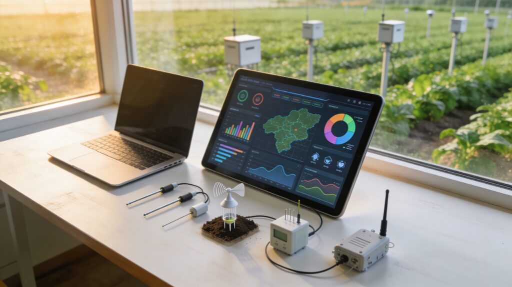
How the Workflow Actually Looks
Implementing drone technology in agriculture involves a systematic workflow, from hardware setup to data interpretation and actionable decision-making. It’s a process that integrates various technological components to deliver tangible results.
Components of an Agricultural Drone System
A complete agricultural drone system comprises several key elements working in concert.
- The Drone Platform:
- Multirotor Drones: These are the most common type for agriculture dueg to their vertical take-off and landing (VTOL) capabilities, ability to hover, and precise maneuverability. They are ideal for detailed inspections and targeted spraying over smaller to medium-sized fields. Typical flight times range from 20-45 minutes.
- Fixed-Wing Drones: Resembling small airplanes, fixed-wing drones are designed for endurance and covering large areas quickly. They require a runway for take-off and landing (or catapult launch/net recovery) but can stay airborne for hours. They are excellent for large-scale mapping and surveying.
- Sensors and Cameras: The “eyes” of the drone, these are crucial for data collection.
- RGB Cameras: Standard visible light cameras for high-resolution visual imagery.
- Multispectral Cameras: Capture specific bands of light (e.g., green, red, red-edge, near-infrared) to assess plant health.
- Thermal Cameras: Detect heat signatures, useful for identifying water stress, disease, or animal health issues.
- LiDAR (Light Detection and Ranging): Uses laser pulses to create highly accurate 3D models of terrain and crop canopy, especially useful for complex terrain or dense vegetation where photogrammetry might struggle.
- Ground Control Station & Software: This is the brain of the operation.
- Flight Planning Software: Used to define flight paths, altitudes, overlap percentages, and camera settings.
- Data Processing Software: Stitches individual images into orthomosaics, generates vegetation indices, and creates 3D models. This software often runs on powerful computers or cloud-based platforms.
- Farm Management Information Systems (FMIS): Integrates drone data with other farm data (soil samples, yield monitors) to provide a holistic view for decision-making.
Image Capture and Data Collection
The process begins with meticulous planning to ensure high-quality data.
- Pre-flight Planning: Using specialized software, the farmer or drone operator defines the area to be surveyed. This involves setting the flight altitude (which determines image resolution), flight speed, and the overlap percentage between consecutive images (crucial for accurate stitching). Safety parameters, such as geofencing, are also established.
- Automated Flight Execution: Once the flight plan is uploaded, the drone typically flies autonomously, following the pre-programmed path. Sensors automatically capture images or data at specified intervals. The operator monitors the flight from the ground control station, ready to intervene if necessary.
- Raw Data Acquisition: The drone’s onboard storage collects all the raw images, spectral data, or LiDAR scans. This raw data is then transferred to a computer for the next stage.
Data Processing and Analysis
This is where raw data is transformed into meaningful information.
- Image Stitching and Georeferencing: Individual images are uploaded to specialized photogrammetry software. This software uses algorithms to identify common points across overlapping images and “stitch” them together into a single, seamless orthomosaic map. Crucially, these maps are georeferenced, meaning every pixel is assigned precise geographical coordinates.
- Generating Vegetation Indices: For multispectral data, the software calculates various vegetation indices (e.g., NDVI, NDRE, SAVI). These indices visually represent plant health and vigor across the field, typically displayed as color-coded maps where different colors correspond to different health levels.
- 3D Model Creation: For terrain mapping, the software uses stereoscopic principles to create detailed 3D models and elevation maps.
- Cloud-based Platforms and AI/ML Algorithms: Many modern drone data platforms are cloud-based, allowing for rapid processing and analysis without requiring powerful local hardware. These platforms often incorporate artificial intelligence (AI) and machine learning (ML) algorithms to automatically detect anomalies, classify weeds, quantify plant populations, or even predict yield. For a deeper dive into these capabilities, explore our piece on Big Data Analytics: Unlocking Business Value.
Decision-Making and Actionable Insights
The ultimate goal of drone data is to inform better farming decisions.
- Interpreting Maps and Reports: Farmers analyze the processed maps (orthomosaics, NDVI maps, elevation models) and accompanying reports. They can identify specific problem areas, understand spatial variability, and track changes over time.
- Creating Prescription Maps: Based on the analysis, farmers can generate “prescription maps” or “zone maps.” These digital maps outline varying application rates for fertilizers, pesticides, or water for different parts of the field.
- Integrating with Farm Management Systems: Drone data is often integrated with other farm management information systems (FMIS) and precision agriculture equipment (e.g., variable rate spreaders, intelligent irrigation systems). The prescription maps are loaded directly into these machines, which then automatically adjust their operations as they move through the field, ensuring precise application according to the drone-derived insights. This seamless integration ensures that data translates directly into targeted actions, optimizing resource use and maximizing efficiency.
Benefits for Farmers
The adoption of agricultural drones offers a compelling array of advantages that contribute to more productive, sustainable, and profitable farming operations.
- Enhanced Precision and Efficiency: Drones allow for highly targeted interventions. Instead of treating an entire field, farmers can address specific areas with issues, leading to more efficient use of resources like water, fertilizers, and pesticides. This precision minimizes waste and ensures that inputs are delivered exactly where they are needed.
- Improved Crop Yield and Quality: Early detection of problems like disease, pests, or nutrient deficiencies enables timely intervention. By addressing issues before they severely impact crop health, farmers can prevent significant losses and ensure a higher quality harvest. Optimized irrigation and fertilization also contribute directly to healthier plants and better yields.
- Significant Cost Savings: The ability to apply inputs precisely translates into substantial cost reductions. Less fertilizer, fewer pesticides, and optimized water use directly lower operational expenses. Furthermore, drones can reduce labor costs associated with manual scouting and spraying, and minimize fuel consumption compared to traditional machinery.
- Time Savings and Scalability: Drones can survey vast areas of land in a fraction of the time it would take human scouts or ground vehicles. This speed is critical during crucial growth stages when timely intervention can make a significant difference. A single drone can monitor hundreds of acres in a day, making it a highly scalable solution for large farms.
- Environmental Sustainability: Reduced reliance on broad-spectrum chemical applications means less chemical runoff into waterways and decreased overall environmental impact. Optimized water use conserves a vital natural resource. By promoting more sustainable practices, drones help farms meet environmental regulations and build a more eco-friendly operation. Our article on Sustainable Technology: Innovation for a Greener Future elaborates on the broader context of such innovations.
- Data-Driven Decision Making: Drones provide objective, quantifiable data that empowers farmers to make informed decisions rather than relying on guesswork or traditional methods. The ability to track changes over time, identify trends, and analyze performance across different areas of a field allows for continuous improvement in farm management strategies. This aligns perfectly with the principles of Data Analytics for Business Growth, applied directly to agriculture.
- Increased Safety: Drones can perform tasks in hazardous conditions or difficult-to-access areas, reducing the need for human exposure to chemicals, heavy machinery, or dangerous terrain.
Limitations and Risks
Despite their transformative potential, agricultural drones are not without their challenges. Understanding these limitations is crucial for realistic implementation and effective risk management.
- Regulatory Hurdles: Drone operations are subject to strict regulations by aviation authorities (e.g., FAA in the U.S., EASA in Europe). These regulations cover pilot licensing, airspace restrictions, flight altitudes, line-of-sight requirements, and rules for operating beyond visual line of sight (BVLOS). Navigating these complex and often evolving legal frameworks can be challenging and requires significant effort to ensure compliance. Privacy concerns, especially when operating near populated areas, also need careful consideration.
- Initial Investment and Operating Costs: While the long-term benefits are substantial, the upfront cost of acquiring a high-quality agricultural drone system can be significant. This includes the drone itself, specialized sensors (multispectral, thermal, LiDAR), flight planning software, data processing software, and potentially cloud subscriptions for advanced analytics. Maintenance, repairs, and battery replacements also contribute to ongoing operating expenses.
- Technical Expertise and Pilot Skills: Operating agricultural drones effectively requires more than just basic flying skills. Operators need to understand flight planning software, sensor calibration, data collection best practices, and be proficient in interpreting the complex data generated. They must also possess a strong understanding of agricultural principles to translate data insights into practical farming decisions. The learning curve can be steep, and skilled personnel are essential.
- Weather Dependency: Drones are highly susceptible to weather conditions. Strong winds can make stable flight and accurate data capture difficult or impossible. Rain can damage electronics and sensors, and extreme temperatures can affect battery performance and overall drone reliability. This means operations can be frequently postponed or canceled, impacting scheduling and efficiency, especially during critical farming seasons.
- Battery Life and Payload Limitations: Current battery technology limits the flight time of most multirotor agricultural drones, typically to 20-45 minutes. This means frequent battery changes and limits the area a single drone can cover in one flight. While fixed-wing drones offer longer endurance, they are less maneuverable. Payload capacity also dictates the type and size of sensors or spray tanks a drone can carry, influencing its operational capabilities.
- Data Management and Cybersecurity: Agricultural drones generate massive amounts of data. Storing, managing, and securely processing this data can be a significant challenge. Farmers need robust data infrastructure and cybersecurity measures to protect sensitive information about their operations and land. Ensuring data privacy and preventing unauthorized access are critical concerns.
Conclusion
Agricultural drones represent a paradigm shift in how farming is conducted, moving from broad-stroke management to hyper-localized, data-driven precision. From meticulous crop monitoring and detailed field mapping to targeted spraying and comprehensive livestock management, UAVs are empowering farmers with unprecedented insights and capabilities. The workflow, encompassing sophisticated hardware, intelligent software, and advanced analytics, transforms raw aerial data into actionable intelligence, leading to enhanced efficiency, improved yields, significant cost savings, and greater environmental sustainability.
While challenges such as regulatory complexities, initial investment, the need for specialized skills, and weather dependency remain, the trajectory of agricultural drone technology is undeniably upward. As hardware becomes more affordable, software more intuitive, and regulations mature, drones are poised to become an even more ubiquitous and indispensable tool in the global effort to feed a growing population sustainably. For those in agriculture, embracing this technology is not just about adopting a new tool; it’s about investing in a smarter, more productive, and resilient future for farming.